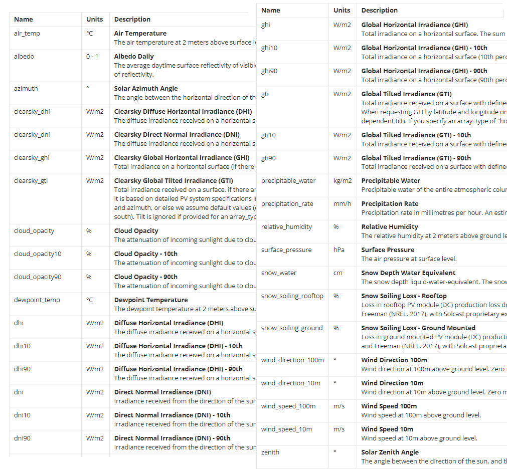
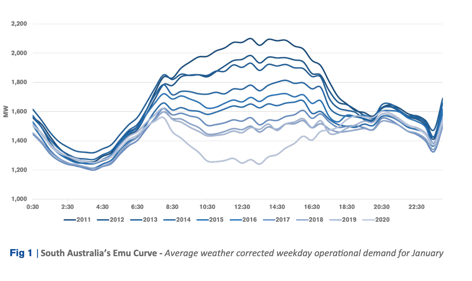
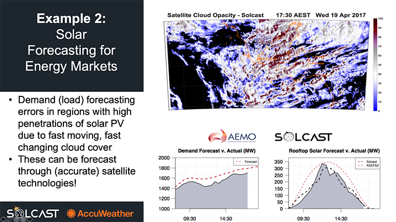
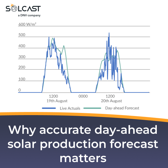
.png)

Harry Woods
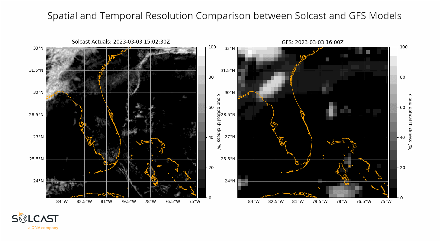
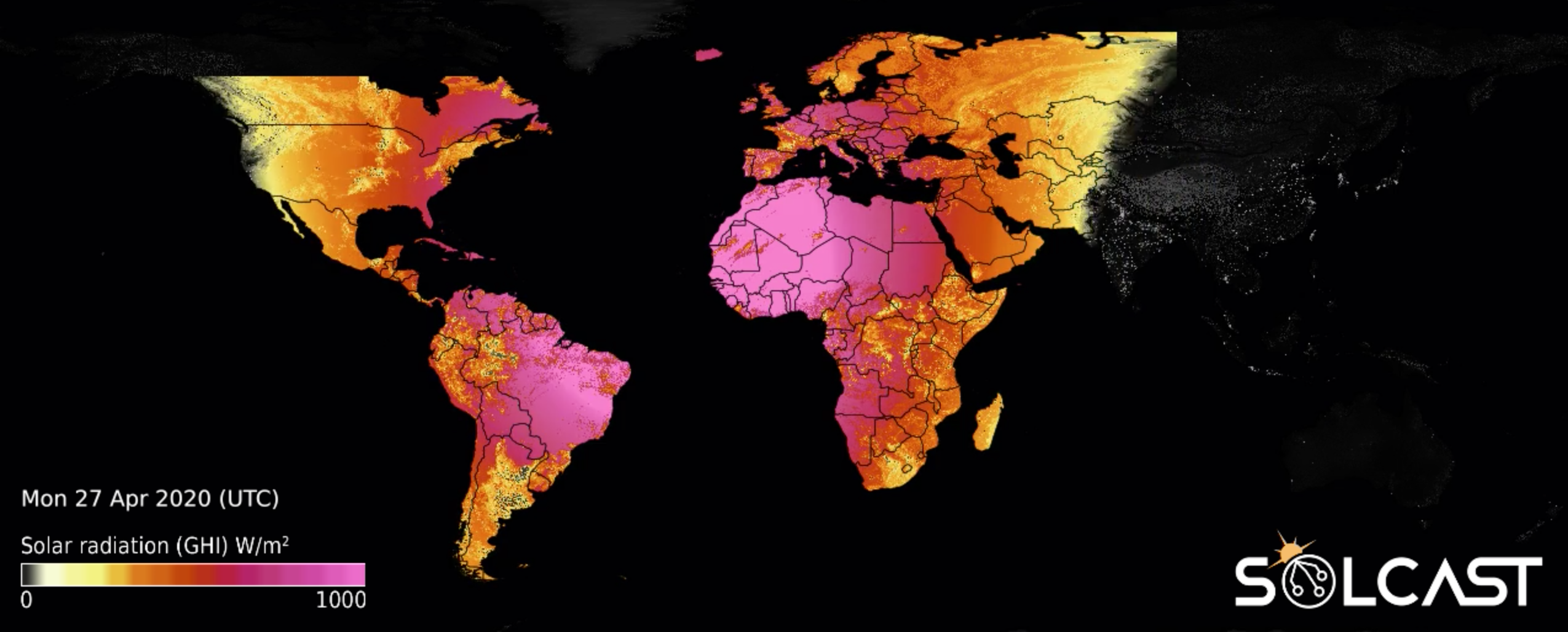
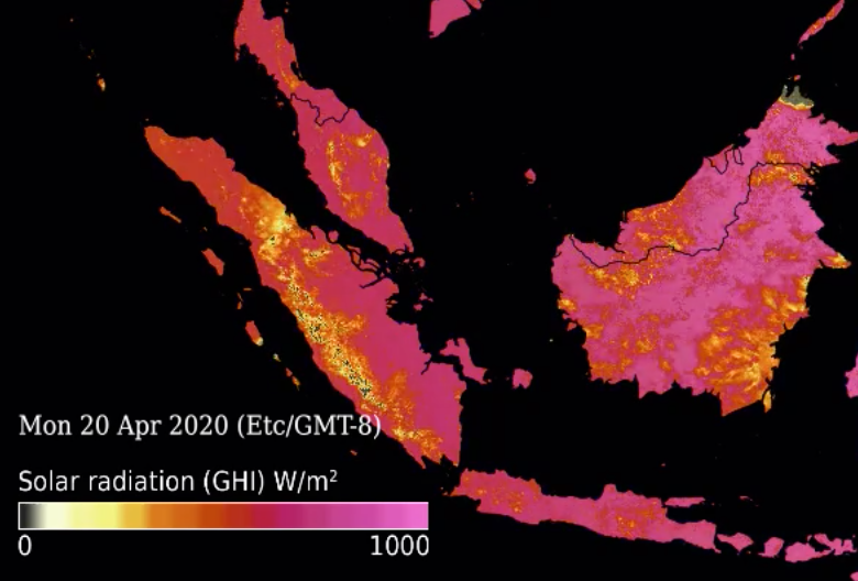
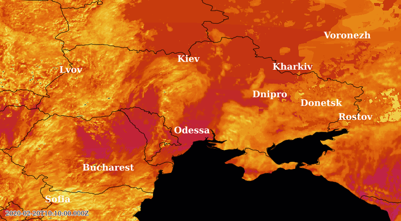
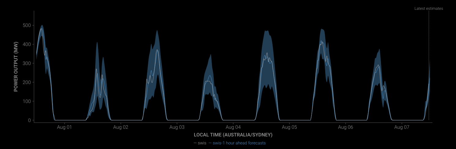
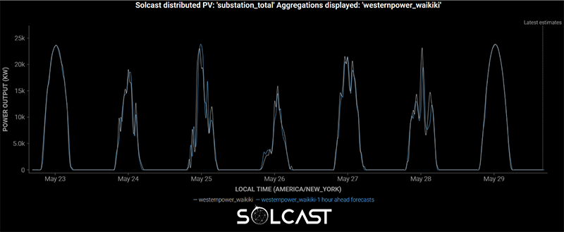
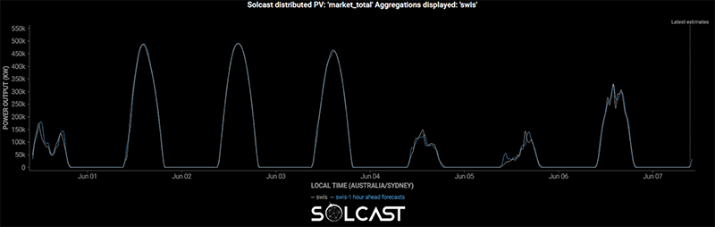
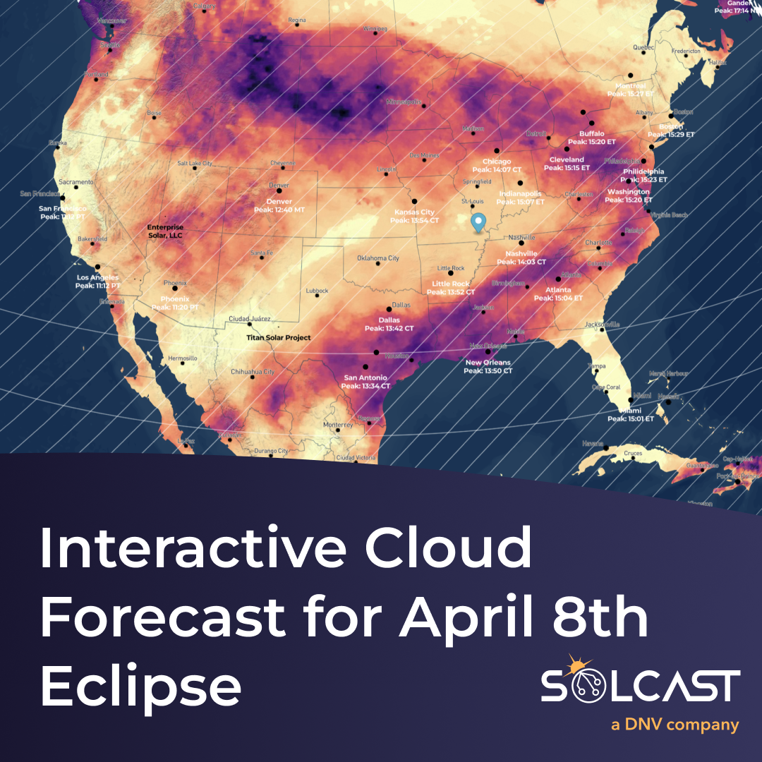
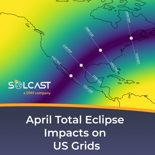
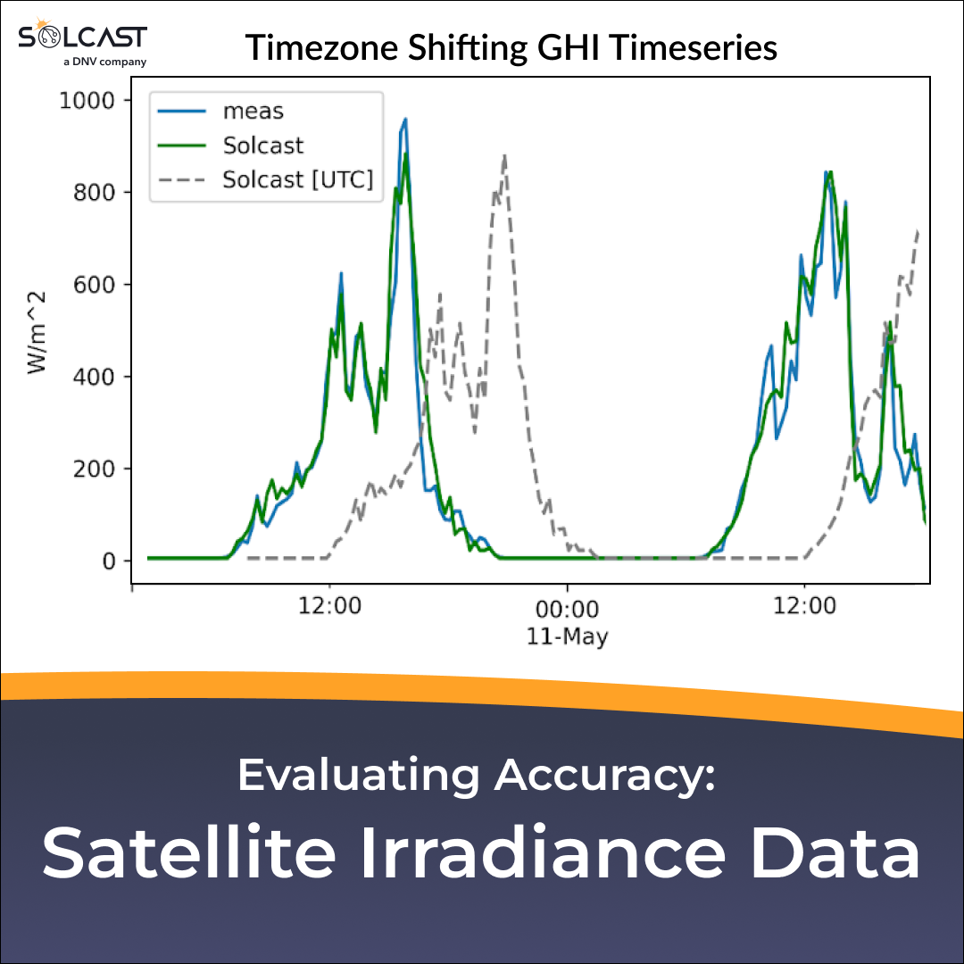
Eclipse and weather impacts on solar generation across the US
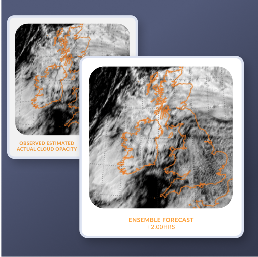
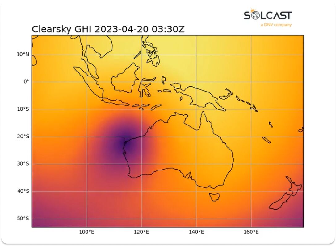
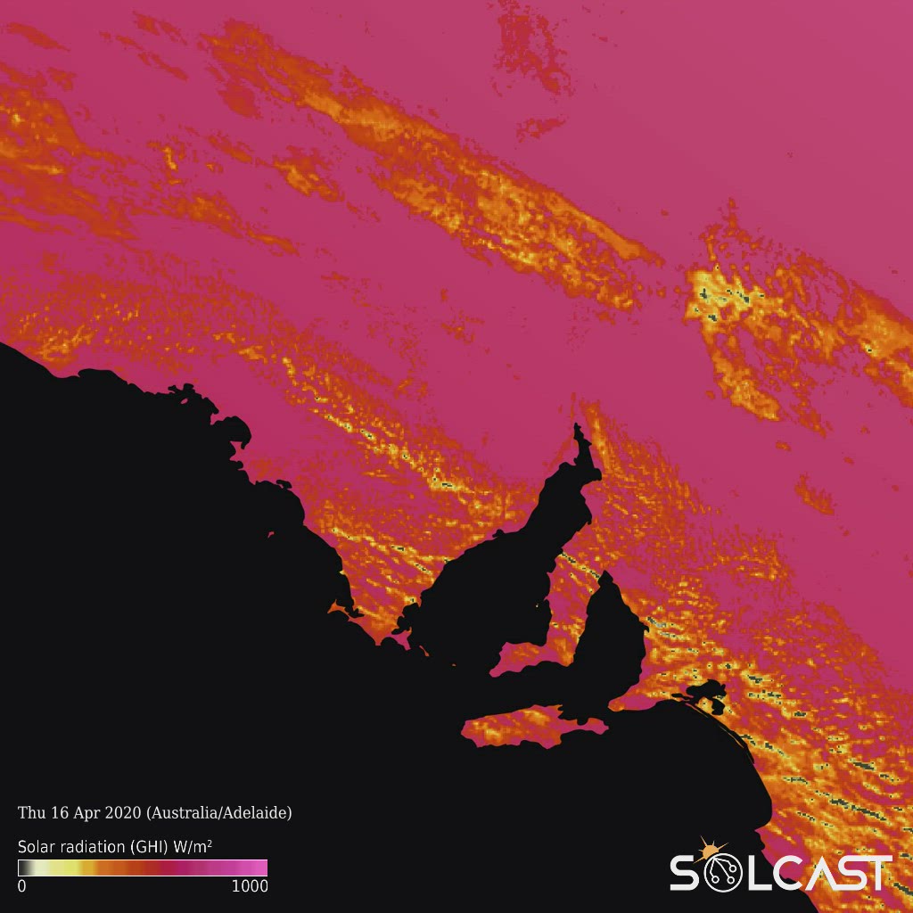
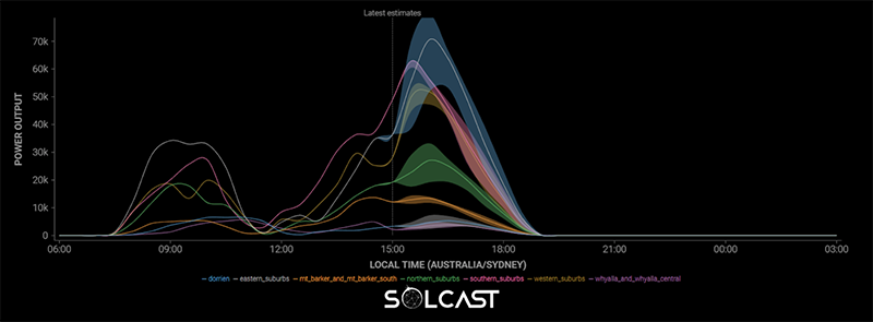
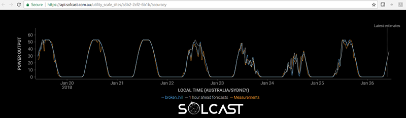
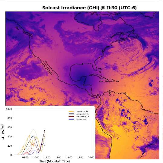
Check out the unique view of the eclipse showing the live actuals for the eclipse path and weather impacts on irradiance. The effects on solar generation across American assets and grids were analysed using the Solcast API.


.png)