


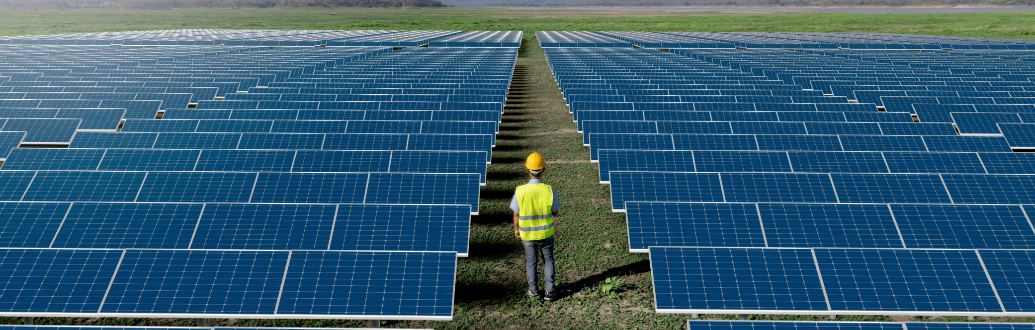
Typical Meteorological Year
Download a statistically representative “typical year” file built from 15 + years of satellite data for long-term yield modelling.
IRRADIANCE , WIND AND WEATHER DATA
Power Forecasting Models
Insights
Validations
IRRADIANCE AND WEATHER DATA
Historical Time Series
Typical Meteorological Year
Live Data
Forecast Data
POWER FORECASTING MODELS
DNV GREEN DATA PRODUCTS
Solcast is independently validated as the lowest uncertainty solar resource dataset
PVGIS (Photovoltaic Geographical Information System) is a widely used platform for solar resource data and PV performance simulations. However, PVGIS relies on multiple datasets for irradiance and weather data, which vary by region and quality. This page explains PVGIS’s data sources, their limitations, and how Solcast compares as a global, bankable alternative.
PVGIS does not use a single global dataset. Instead, it combines several sources:
Solcast | PVGIS | |
|---|---|---|
Free trial with instant access and data download? | | |
Real time data available? | | |
Comprehensive, global, independent validation | | |
Satellite based estimation | | |
Coverage | Global | SARAH-3: Europe, Africa, Middle East |
Resolution of satellite data used | 1-2 km | 4-30 km |
15+ years of satellite data at full temporal resolution | | |
| |
Source: PVGIS data sources & calculation methods - The Joint Research Centre: EU Science Hub
The PVGIS SARAH and Solcast methodology is relatively similar. Both are semi-empirical and are satellite-derived. Both rely on validated, published models to build a clear sky model, and use proprietary cloud detection. The PVGIS-SARAH cloud model has a lower resolution, based around a 5 km grid, compared to Solcast's upres 90 metre resolution. The cloud detection algorithm only processes one image per hour, instead of the native satellite time step. This large time step between satellite images can provide misleading information on cloud formation, tracking, and opacity. Solcast has real-time data available, whereas PVGIS SARAH ends in 2020.
Solcast | PVGIS (SARAH 2.1) | PVGIS (SARAH 2.1) | |
|---|---|---|---|
Performed by | DNV | IEA PVPS | Yang & Bright 2020 |
Year published | 2023 | 2023 | 2020 |
No. of sites | 73 | 54 | 20 |
Mean Bias | +0.26% | +0.45% | +0.76% |
Bias Std. Dev. | ±2.17% | ±6.60% | ±12.44% |
Mean nMAD (nMAE) | 10.92% | 11.04% | Not Published |
Mean nRMSD (nRMSE) | 16.97% | 16.88% | 28.24% |
Solcast | PVGIS (SARAH 2.1) | |
|---|---|---|
Performed by | DNV | IEA PVPS |
Year published | 2023 | 2023 |
No. of sites | 48 | 54 |
Mean Bias | +0.10% | +1.77% |
Bias Std. Dev. | ±5.33% | ±13.19% |
Mean nMAD (nMAE) | 18.71% | 24.96% |
Mean nRMSD (nRMSE) | 29.48% | 35.23% |
EU Science Hub (2023). PVGIS data sources & calculation methods: Validation of the satellite-based solar radiation data
Yang, D., 2018. A correct validation of the national solar radiation data base (NSRDB). Renewable and Sustainable Energy Reviews, 97, pp.152-155.
Yang, D. and Bright, J.M., 2020. Worldwide validation of 8 satellite-derived and reanalysis solar radiation products: A preliminary evaluation and overall metrics for hourly data over 27 years. Solar Energy, 210, pp.3-19.
Forstinger, A., et al. (2023). Worldwide benchmark of modelled solar irradiance data (2023 PVPS Task 16): Solar resource for high penetration and large-scale applications. ResearchGate.
Cuevas-Agulló, E., et al. (2023). A new global high-resolution solar resource dataset. Zenodo.

Download a statistically representative “typical year” file built from 15 + years of satellite data for long-term yield modelling.
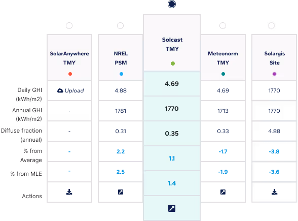
Compare multiple satellite data sets side-by-side to choose the most bankable resource file for your site.
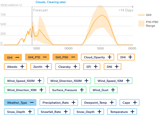
Access industry-leading solar forecasts up to 14 days ahead, combining satellite nowcasting and weather models for precision energy planning.
Subscribe to our newsletter to keep up to date with all the latest news.
Subscribe to our newsletter to keep up to date with all the latest news.