Storm Boris has brought a mix of extreme weather to Europe, ranging from heavy rainfall and flooding to the first snows of autumn, according to analysis using the Solcast API. This low-pressure system, named Boris by Italy’s Servizio Meteorologico, unleashed record-breaking rain across Central Europe, while the UK and parts of the Alps saw their first snow. The situation is now stabilising as the system weakens and a high-pressure zone takes hold across the region.
.avif)
Central Europe faced severe flooding as Storm Boris delivered record breaking rainfall levels, with some regions experiencing unprecedented precipitation totals. The convergence of cold Arctic air with warmer Mediterranean and Caspian Sea air masses resulted in persistent rain and snow across the region. A portion of the low-pressure system became trapped over the Adriatic, forming a slow-moving secondary system that prolonged the rain, leading to several days of downpours. In some areas, months' worth of rainfall fell within just a few days, overwhelming local infrastructure and prompting severe weather warnings across several countries.
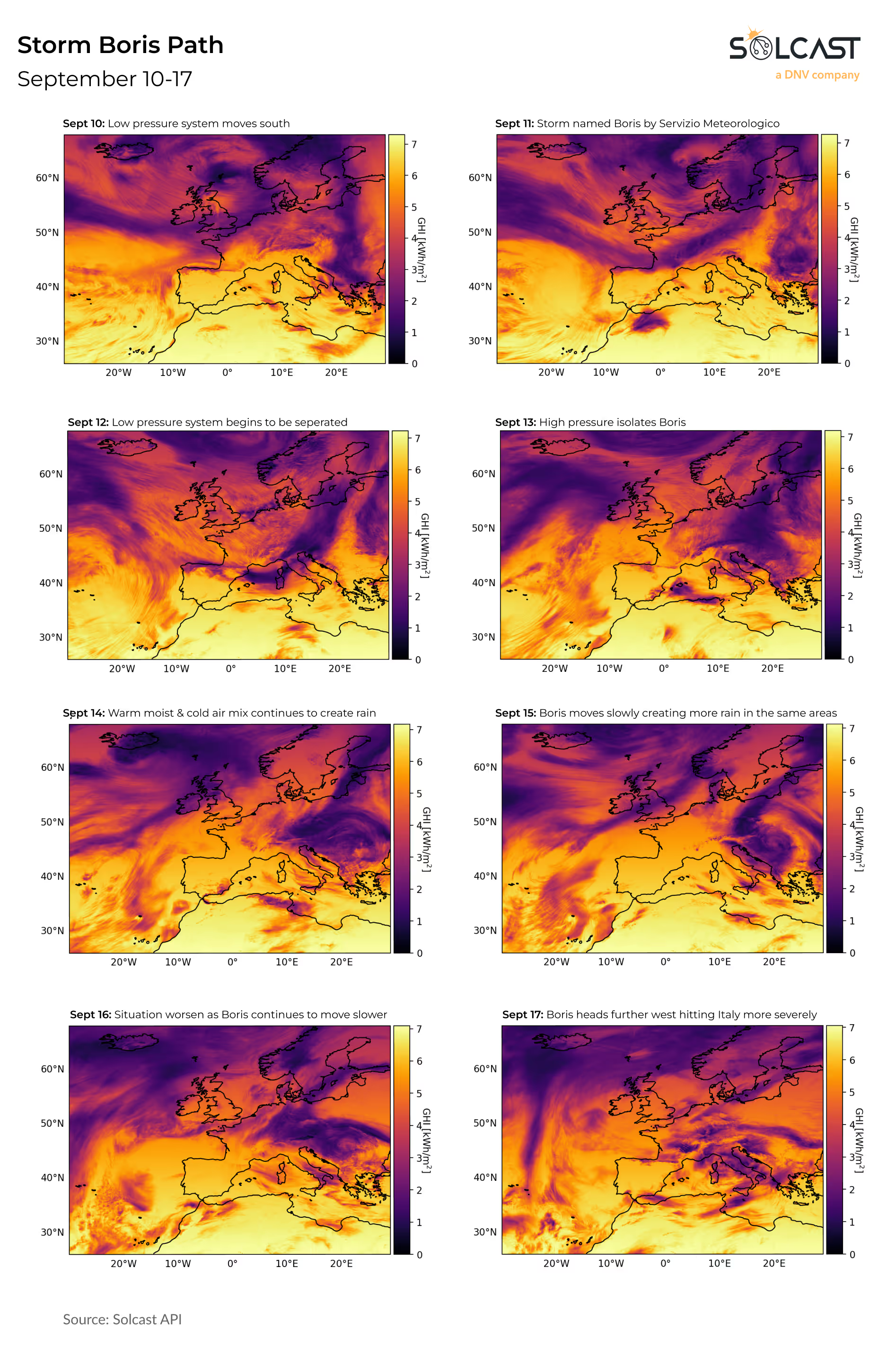
As the storm swept across Europe, snow began falling in some regions for the first time this season. In the UK, Arctic winds dropped temperatures enough for the peaks of Scotland to see their first snow since summer. Italy’s and Austria’s Alpine regions also saw early snowfall, particularly in the higher elevations, where the rain from Storm Boris turned into heavy snow dumps.
Currently, conditions across Europe are less intense as Storm Boris moved over to Italy southeastward. The system has weakened since crossing into Italy but has still continued to cause flooding and prompting evacuations. Forecasts show a brief reprieve from the rain in the coming days before more rainfall next week for Central Europe.


