October delivered record-high irradiance across much of the United States, with a high-pressure system over the Eastern and Central regions driving a sustained period of warm, dry, and clear weather. Meanwhile, contrasting conditions in Canada’s coastal provinces and extreme weather in Florida underscored this month’s diverse impacts on North American solar generation.
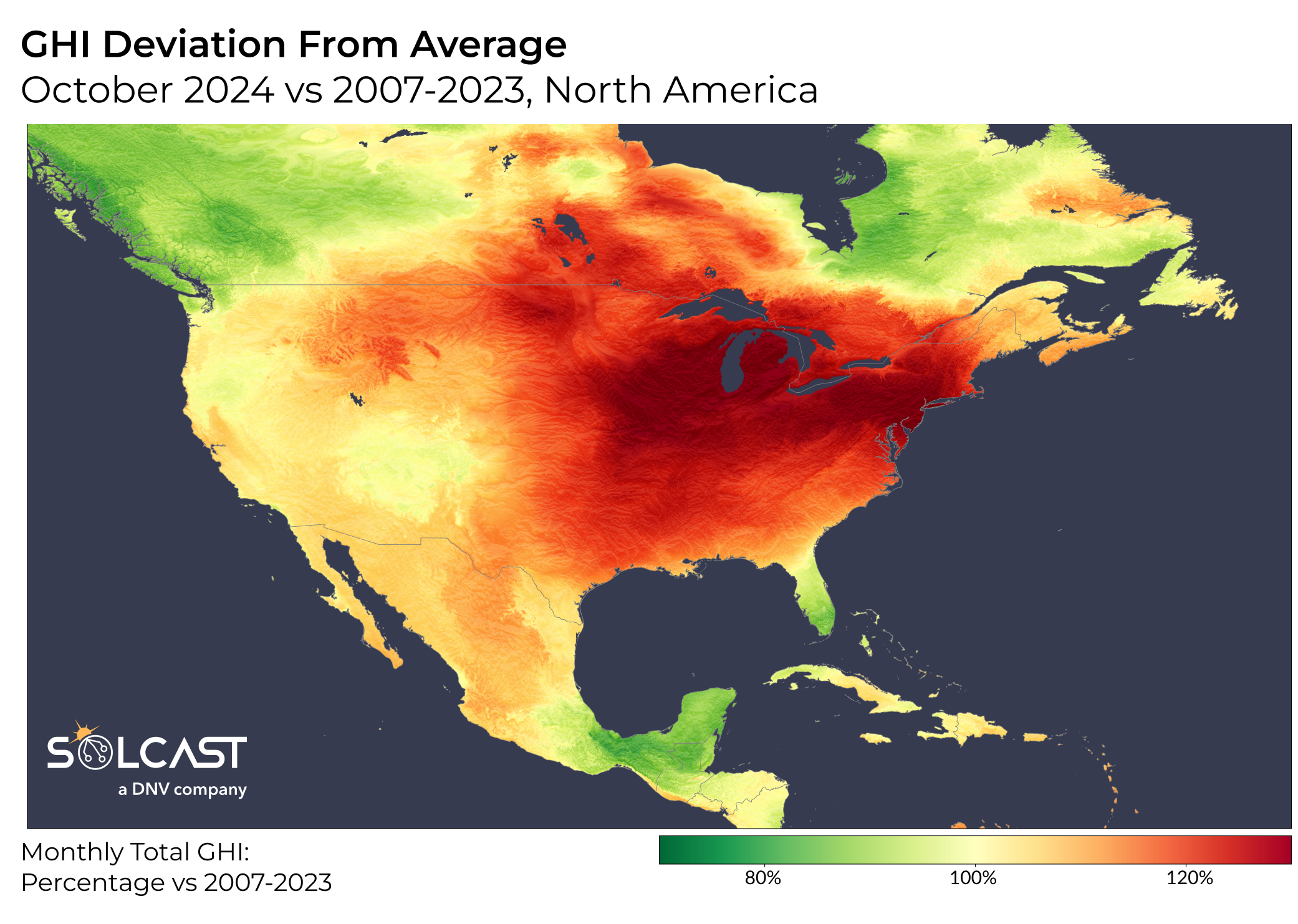
An unusually stable high-pressure zone dominated skies over the Central and Eastern U.S., suppressing cloud formation across much of the country. Clear skies, coupled with minimal rainfall, drove irradiance levels far above seasonal norms, especially in parts of the Midwest and Great Lakes regions.
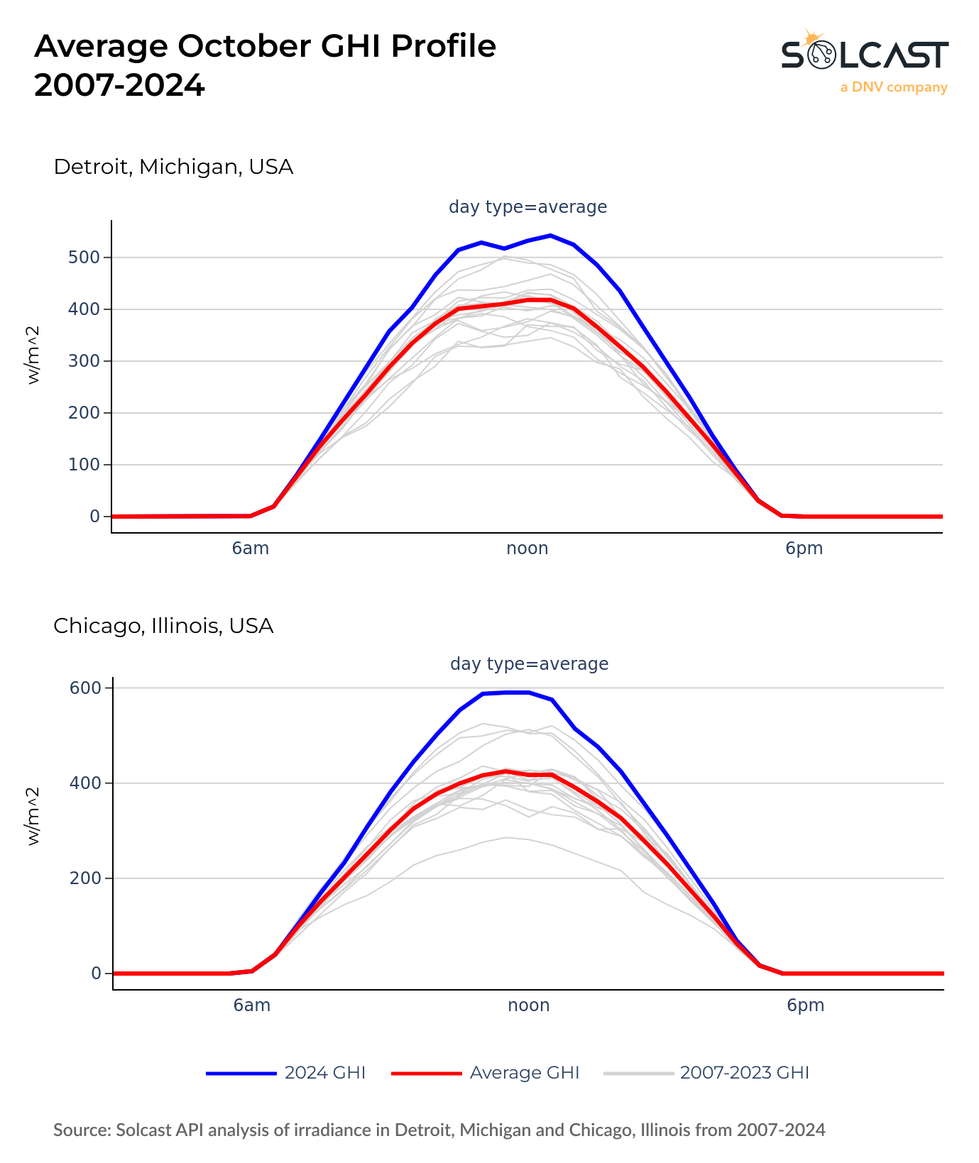
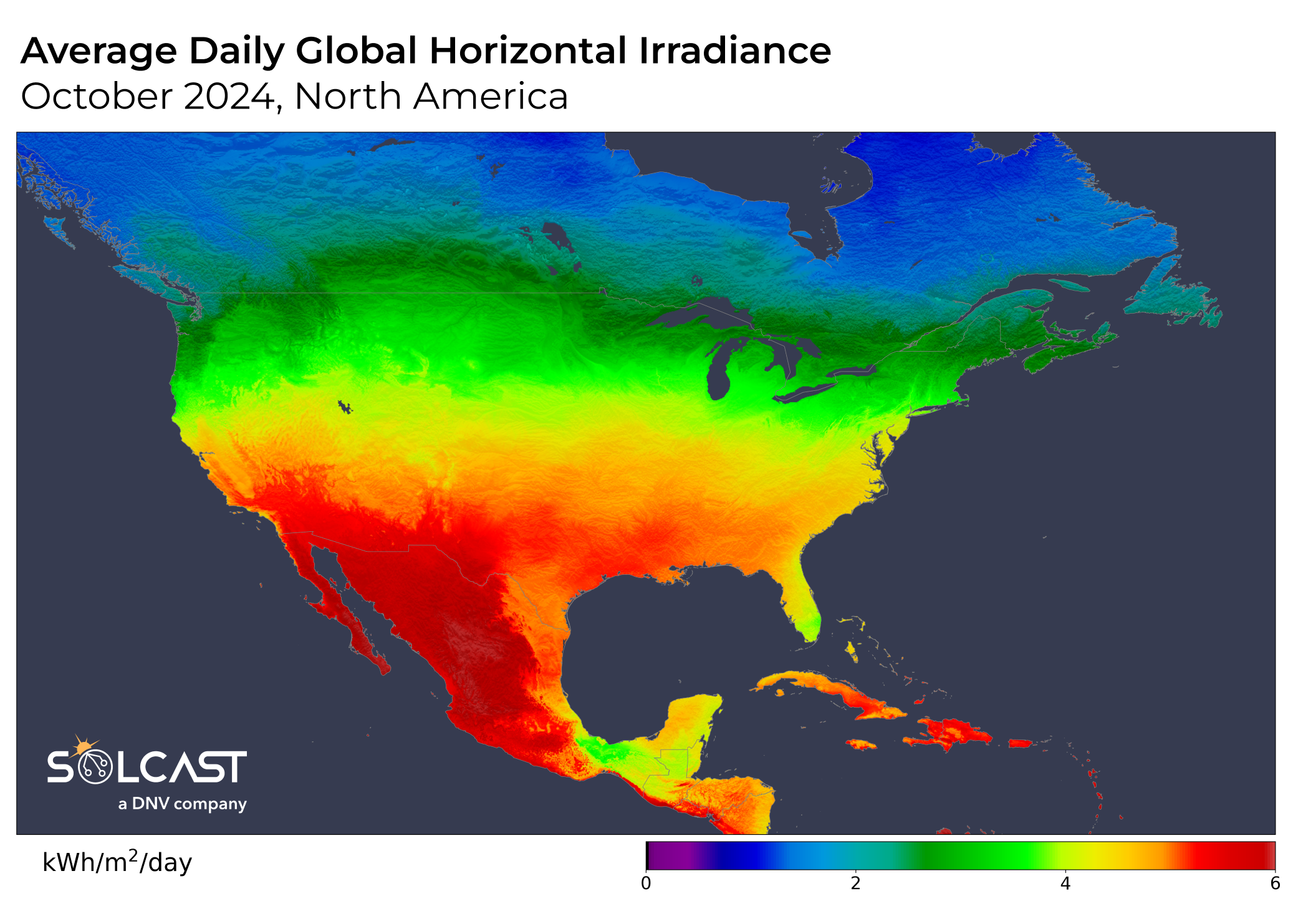
Chicago and Detroit, in particular, saw their highest average monthly irradiance in at least 18 years, with levels up by 40% and 30% respectively compared to a typical October. These metrics also exceeded the second-highest irradiance records by 13% and 8%, respectively. For context, Northern US states saw the same or more irradiance in October than Portugal and Spain. As seen in the data below, solar installations across these areas experienced optimal generating conditions rarely seen in October.
The extreme jet stream position also created a distinct East-West divide in solar irradiance across the U.S. With high pressure more concentrated over the east, irradiance anomalies tapered off further west. The Upper Midwest—covering states like Wisconsin, Michigan, and Illinois—stood out for its high irradiance records. This area benefited from persistently clear weather, experiencing warmer-than-average temperatures that would be more typical of early autumn than mid-October.
While much of the U.S. experienced clear skies, Canada’s British Columbia and Quebec were impacted by lower pressure systems, which brought overcast conditions, frequent rainfall, and strong offshore winds. Irradiance in these coastal provinces dropped to 80% of typical October levels, and mean temperatures were up to 4°C cooler than average. Vancouver, in particular, saw stronger offshore winds and increased rainfall, significantly reducing available sunshine for solar production throughout much of the month.
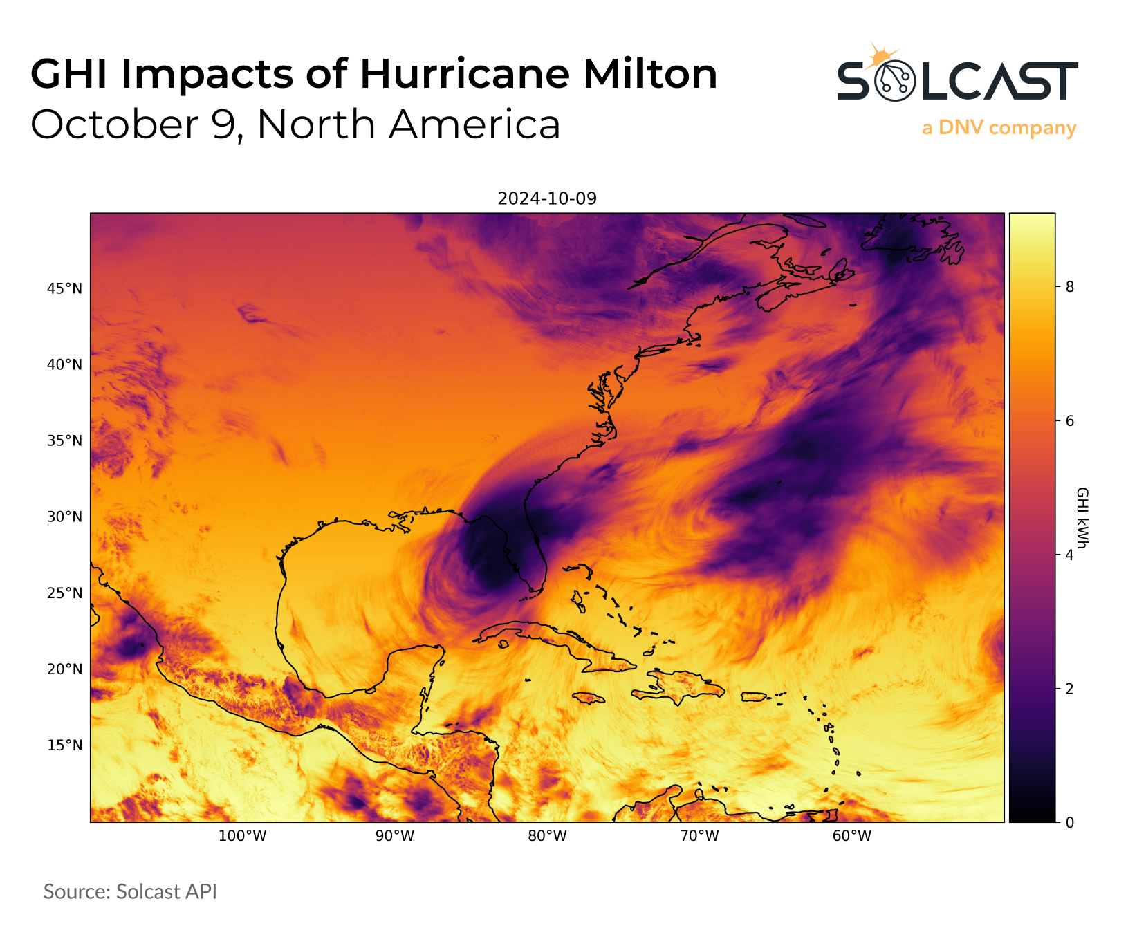
October’s record irradiance highs also contrasted sharply with conditions in Florida, where Hurricane Milton made landfall on October 9, disrupting irradiance across the southeastern U.S.. Milton delivered extreme rainfall and brought severe flash flooding across the state. The impact of the Category 4 hurricane on irradiance is visible in the image above, driving significant irradiance impacts on the day of its landfall, with the associated cloud depressing October irradiance for all of Florida.
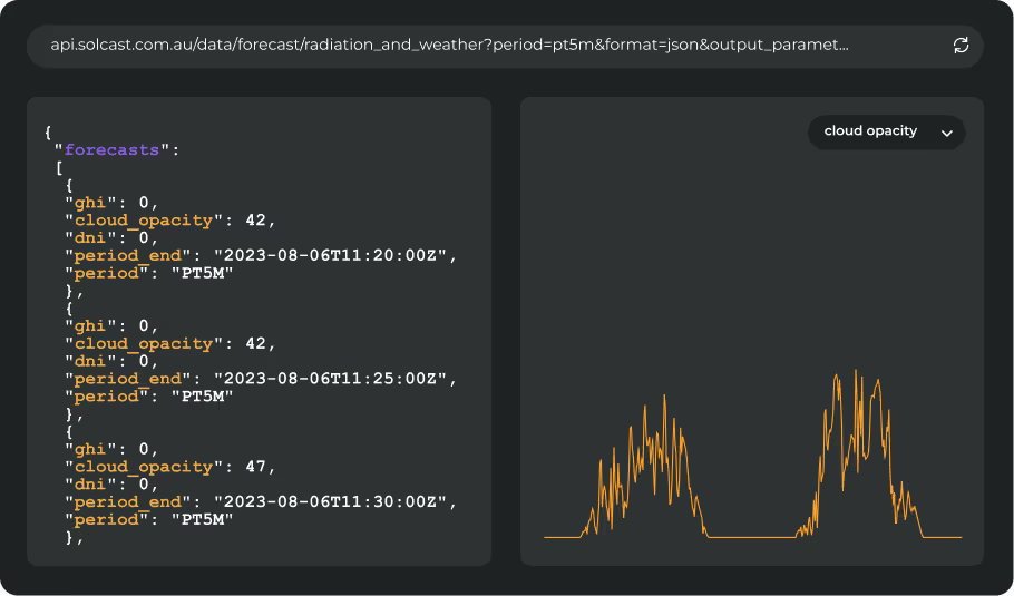
Track weather conditions, cloud movements, and irradiance-influencing factors that impact your solar generation. Access bankable actuals and accurate forecasts when you sign up for a Solcast API toolkit. You can reach out to our team for an extended trial.


